“The purpose of the drafts is to regulate geodetic and cartographic activities, to define the powers of the republican and territorial administration of the RA executive power, local self-government bodies and other entities, the procedure of the international cooperation, as well as dispute resolution and responsibilities for breaking the law,” the Head of the RA Cadastre Committee Suren Tovmasyan noted.
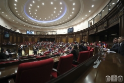
The package of draft law on Geodetic and Cartographic Activities and the related ones authored by the Government was debated in the first reading at the NA regular sitting on November 15.
According to the key rapporteur, the state bodies that collect, create and manage spatial data should create, provide and distribute relevant metadata, as well as maintain and update them in accordance with spatial data collections and services.
The draft will regulate the requirements presenting spatial data, which, if provided, will be included in the national geoportal. It was noted that a national spatial data infrastructure will be introduced.
The member of the RA NA Standing Committee on Economic Affairs Hayk Tsirunyan presented the positive conclusion of the Head Committee on the draft.
